Republican support for a new set of congressional districts is snowballing behind a redistricting plan to carve off a section of Democrat Sharice Davids’ district and replace it with Republican territory farther south.
The same bills introduced in the House and the Senate would split Wyandotte County between Davids’ 3rd District and the 2nd Congressional District represented by Congressman Jake LaTurner.
There is a separate proposal in the House that would put all of Wyandotte County in the heavily Republican 1st Congressional District, but even the map’s sponsor didn’t express strong support for that plan.
With hearings scheduled for later this week, it is very possible for lawmakers to get the proposals to the floor and voted on by sometime next week, setting the stage for one of the biggest moments of the 2022 legislative session.
The governor could potentially veto the bill, which leads back to what the 2020 elections were all about: Could the Republican supermajorities pass their election boundaries over the veto of the governor?
Hundreds of thousands of dollars flowed into Kansas from outside the state during the 2020 legislative elections with redistricting in mind, knowing that the outcome would decide political power in Kansas for a decade or more.
Democrats had hoped that by busting up the supermajority, they would give Democtatic Gov. Laura Kelly more leverage to veto unfavorable redistricting plans.
Republicans prevailed, expanding their supermajority in the House and holding onto what they had in the Senate.
The plan dividing Wyandotte County between the 2nd and 3rd Districts is the one with political momentum, given that it was introduced in the Senate by the chamber’s president and in the House by the chair of the redistricting committee.
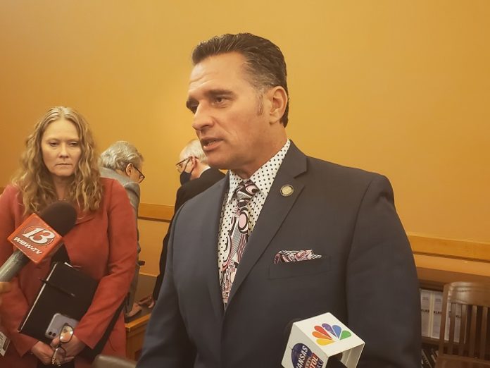
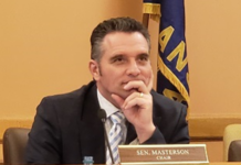
While the bill was introduced in the Senate with little, if any, discussion, Senate President Ty Masterson and Senate Vice President Rick Wilborn issued a strong statement in support of the legislation.
“This map is reflective of the testimony we received from the public, both on the 14-stop listening tour in August and the virtual listening tour in November,” the senators said in their statement.
“The map creates compact and contiguous districts, preserves existing district cores, and groups together communities of interest,” they said.
Democrats have feared for months that Republicans would try to put Davids at a disadvantage as she seeks a third term in Congress.
Davids has been warning her supporters for at least a year that Republicans would try to redistrict her out of office.
“The Kansas GOP is trying to rig the redistricting process and gerrymander our district to make it harder for us to win,” Davids warned in a fundraising email last year.
The Republican redistricting plan would put the northern half of Wyandotte County-wide into the 2nd District and move thousands of Black and Hispanic residents in the urban core out of the 3rd District.
The map would keep Johnson County whole, but it would put rural Miami, Franklin and Anderson counties into the 3rd District, which would offset the Democratic leanings of Wyandotte County and northeastern Johnson County.
Anderson and Franklin counties are extraordinarily Republican and would potentially give Davids a difficult obstacle to overcome.
About 68% of voters in Franklin County went for Donald Trump in 2020, and 77% in Anderson County went for Trump.
It also would move most of Lawrence into the 1st Congressional District, which would dilute a Democratic power base by moving it into such a red congressional district.
Taking Lawrence out of the 2nd District would prevent any Democrat from using the city as a springboard to run for Congress against LaTurner or any other Republican.
“You’re basically taking your margins in Douglas and Shawnee counties and hoping that it can beat the margins in the rural parts of the district,” said Democrat Paul Davis, who came up short in a congressional bid in 2018.
Removing Lawrence from the district just makes it hard for a Democrat to prevail, he said. “I think it would be very, very difficult, if not impossible.”
If passed, the new map could hamstring former Naval intelligence officer Patrick Schmidt’s campaign against LaTurner.
Schmidt, who lives in Topeka, said he thought it was too early to comment on the proposed maps, although the process could be completed very soon.
Senate Minority Leader Dinah Sykes said the plan was drawn up for little more than partisan gain.
“It splits communities of interest while combining communities with no established economic, cultural, or historical ties to the 3rd Congressional District,” Sykes said in a statement.
“And to add insult to injury, it places Lawrence – which has always been in an eastern Kansas district during the modern redistricting era – in the Big First.
“This is clearly an attempt to solve the Democratic problem they’ve created by putting a heavily Democratic portion of Wyandotte in the Second District. It doesn’t pass muster, and it doesn’t serve Kansans fairly.”
Senate Republicans say the districts do include areas of commonality under their redistricting plan.
They point out 2nd District would include several military installations, including Fort Riley, Fort Leavenworth, Forbes Field and the Kansas National Guard.
They note that the 3rd Distruct in their plan keeps Johnson County together, blending the Kansas City suburbs with nearby bedroom communities.
They added that their maps keep all four members of Congress within their districts.
Two maps introduced by Democrats – one in the House and one in the Senate – leave Wyandotte County whole, but slice off the southwest portion of Johnson County and move it into the 2nd District.
Republicans have been privately grumbling how Democrats could insist on keeping Johnson and Wyandotte County together and then back a redistricting plan that doesn’t do that in its entirety.
Over the last decade, the 3rd District had grown to the point where it’s no longer possible to keep Wyandotte and Johnson counties completely in the same district, although there is strong opposition to radically ripping them apart.
The population in the 3rd District is about 792,000, or roughly 58,000 more than the targeted population of 734,000 for the district.
Democratic state Rep. Stephanie Clayton of Overland Park said she didn’t think the Republican map would pass legal muster.
“I just don’t find it to be a very realistic map,” she said. “It just does not seem legal.”


